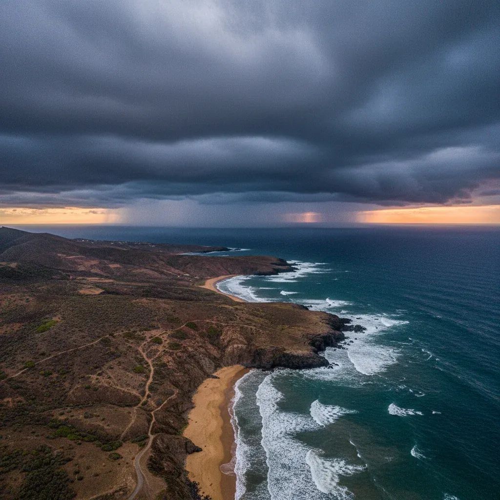
The Madeira Harbour Authority extended maritime weather warnings through April 9, 2025, following a turbulent four-day stretch of northwest winds reaching up to 74 km/h and waves that peaked at 12 meters along the archipelago's northern coast. The warnings have since expired, with the Portuguese Institute for Sea and Atmosphere (IPMA) confirming no active orange or red alerts remain in force across Madeira and Porto Santo as of today.
Why This Matters:
• Ferry services resumed: The Lobo Marinho vessel, which links Madeira to Porto Santo, is expected to return to normal scheduling after cancellations on April 7 and 8 disrupted resident travel and cargo deliveries.
• Economic relief for Porto Santo: The 48-hour maritime isolation resulted in missed business appointments, tourism cancellations, and delayed supply chains for the island's 5,000 residents.
• Conditions stabilizing: Forecast models show temperatures climbing to 18°C–21°C by mid-month, with partial sunshine replacing the heavy swells that defined the first week of April.
Putting This Storm in Perspective
Before diving deeper, it's worth asking: was this a genuine emergency or routine disruption? Madeira's weather history includes catastrophic events—most notably the February 2010 flash floods that claimed 47 lives, the 1803 deluge that killed an estimated 1,000 people, and the 2023 Depression Óscar, which dumped 497.5 millimeters of rain in 24 hours, setting a national record. The April 2025 system, by contrast, remained a moderate maritime hazard with no reported casualties, structural damage, or landslides.
The Depression Claudia in November 2024 generated cyclonic winds of 147 km/h in Santa Cruz, felling trees and flooding streets. April's northwest gale peaked at 74 km/h, well below that threshold. The orange alert classification reflects wave danger rather than wind speed—a distinction critical for mariners but less alarming for inland populations.
Still, the frequency of disruptive weather events appears to be increasing, a trend climate researchers attribute to warmer Atlantic surface temperatures and shifting jet stream patterns. The IPMA logged six orange-level weather warnings in Madeira between January and April 2025, compared to an annual average of four in the preceding decade.
The Storm's Trajectory and Official Response
The weather system originated from a Signal 1 warning issued at 02:40 local time on April 7 by the IPMA, flagging northwest gales and rising sea states. The Funchal Harbour Authority immediately advised vessel owners and commercial operators to secure moorings and postpone non-essential departures, a protocol repeated three times over 72 hours as conditions worsened.
Orange-level alerts covered the north coast of Madeira and the entire Porto Santo island from 15:00 on April 7 until 12:00 on April 9, the highest tier short of a red warning. Wave heights averaged 5 to 7 meters in open water, with individual swells documented at twice that figure. The west-facing stretch of Madeira's southern shore saw more moderate but still hazardous conditions, with 3- to 4-meter waves and winds shifting from moderate to strong by nightfall.
Visibility dropped to "poor to moderate" levels by afternoon on April 8, compounding navigational risks. The harbour authority issued blanket advisories to "the entire maritime community and the general public" regarding activities near coastlines, ports, and anchorages.
Porto Santo Line Scrambles to Minimize Disruption
The Porto Santo Line concession, operator of the Lobo Marinho ferry, pulled the plug on scheduled crossings for April 7 and 8, citing unsafe docking conditions. The decision stranded dozens of travelers and forced the company to arrange emergency outbound sailings ahead of the weather window, a stopgap measure that partially mitigated but did not eliminate the backlog.
The ferry is the primary freight and passenger link between the two islands. With no backup vessel in service—a recurring complaint from regional opposition parties JPP and PS—the cancellation left Porto Santo's 5,400 permanent residents without reliable access to medical appointments, business meetings, and family visits on the main island.
Tourism operators also absorbed financial hits. Porto Santo, marketed as the "Golden Island" for its 9-kilometer beach, relies on day-trippers and weekend visitors from Madeira during shoulder-season months like April. Hotel occupancy rates typically climb toward 60% during this period, but the two-day blackout likely shaved several percentage points off projections.
What This Means for Residents and Investors
For expatriates and long-term residents based in Madeira or Porto Santo, the event underscores the archipelago's vulnerability to Atlantic weather systems and the limited redundancy in inter-island transport. Unlike the Azores, which operate multiple ferries and robust air service between islands, Madeira's model depends on a single vessel and a handful of daily flights that are themselves weather-dependent.
The economic cost of each cancellation day compounds over time. Local supermarkets on Porto Santo report temporary shortages of perishable goods; construction projects face delays when materials fail to arrive; and sports clubs postpone fixtures, disrupting community schedules. The absence of a contracted backup ferry during the annual maintenance period in January 2025 drew sharp criticism from municipal councils, and this week's disruptions reignite those frustrations.
Investors in Porto Santo's hospitality sector should factor in an average of 8 to 12 cancellation days per year due to weather or technical maintenance, according to historical data from the concession. That's roughly 3% of the year—a significant concern for a market already limited to peak tourist months.
Outlook: Gradual Return to Stability
The IPMA's extended forecast anticipates stable conditions from mid-April onward, with daytime highs in Funchal reaching 19°C–22°C and overnight lows hovering around 14°C–17°C. Porto Santo will track slightly cooler, with maximum temperatures of 18°C–21°C and intermittent cloud cover.
Isolated showers may persist through April 15, particularly in the São Vicente region on Madeira's northern flank, where orographic lift concentrates precipitation. By April 17, partial sunshine and dry spells should dominate the weather pattern, aligning with the archipelago's typical late-spring profile.
For mariners and coastal businesses, the takeaway is operational: northwest swells exceeding 5 meters remain a seasonal reality from late autumn through early spring. The Funchal Harbour Authority maintains a 24-hour warning hotline and updates conditions via VHF Channel 16, but vessel operators are expected to monitor IPMA bulletins independently and adjust schedules preemptively.
Ferry passengers should note that the Lobo Marinho's cancellation policy typically allows full refunds or rebooking without penalty when the company invokes force majeure. However, connecting flights, hotel reservations, and vehicle rentals fall outside that coverage, making travel insurance a prudent investment for anyone planning inter-island trips during transitional weather months.
The April 2025 episode reinforces a broader lesson for anyone living in or investing in Madeira: the archipelago's geographic position—900 kilometers from mainland Portugal, exposed to Atlantic fronts—demands contingency planning and flexibility. Whether you're a resident scheduling medical care in Funchal or a developer coordinating construction shipments to Porto Santo, weather-related delays are a structural feature of island logistics, not an anomaly.