Strong winds, high swells and the familiar wail of civil-defence sirens will remain part of Madeira’s soundtrack for at least another 48 hours. Anyone in mainland Portugal plotting a quick island getaway – or simply waiting for parcels to reach Funchal – should brace for continued weather-related hiccups.
Key points at a glance
• Weather alerts now run until 18:00 Sunday for the entire archipelago.
• North-facing coasts face 5-7 m waves, easing slowly to 3 m.
• Gusts may still touch 74 km/h, especially on exposed headlands.
• Porto Santo ferry and dozens of flights already scrapped this week.
• Capitania urges tighter moorings and a halt to recreational fishing.
Why the extension matters
For Madeira’s island economy, every weather window counts. Perishable cargo, Christmas tourists, local fishermen, inter-island commuters, airport handlers, cruise-ship agents, hotel managers, and diaspora families on the mainland all depend on predictable sea and air links. December’s back-to-back Atlantic depressions – first “Emília”, now “Bram” – have replaced that predictability with a roulette wheel of cancellations.
What the latest advisory includes
The new notice from the Capitania do Porto do Funchal leans on fresh data from IPMA and highlights three main hazards:
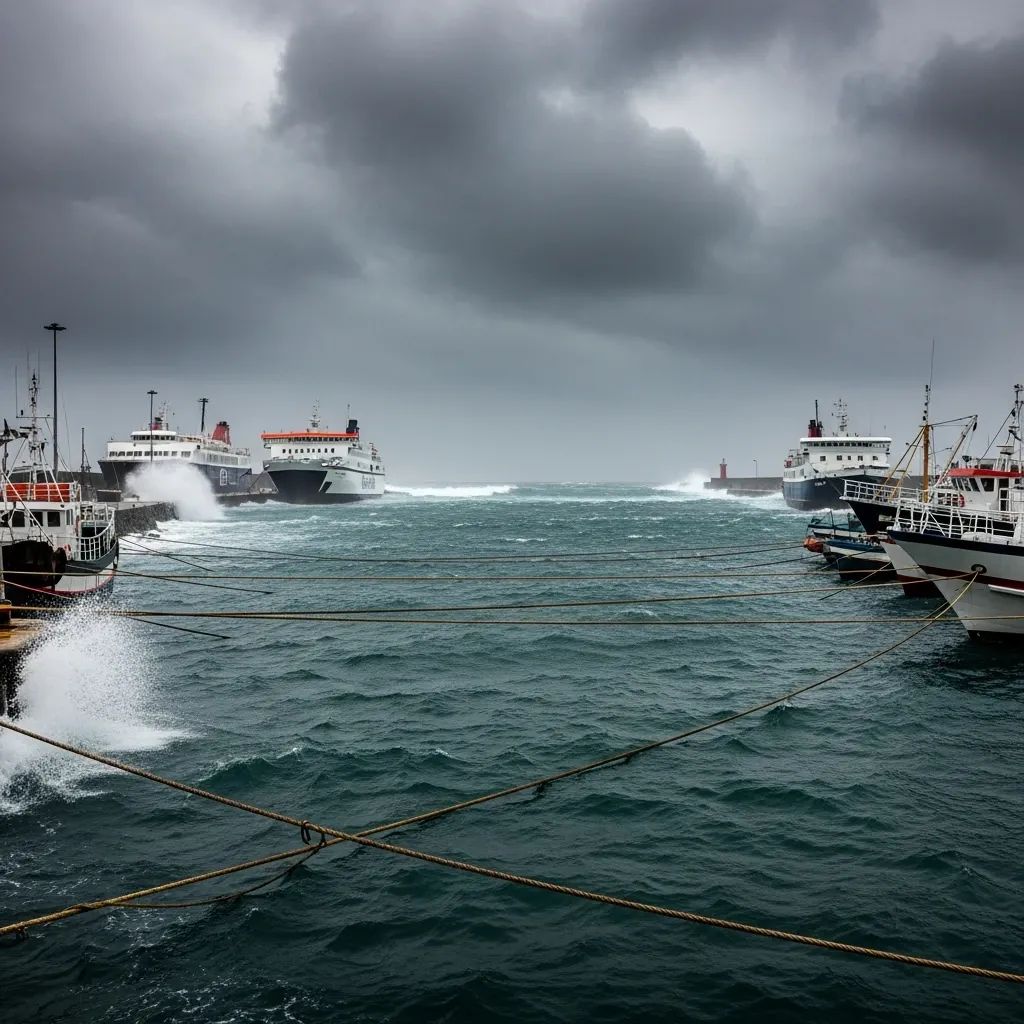
Wind: Sustained northerlies of 51-74 km/h, with sporadic bursts over cliff-tops.
Swell: North-west sets of 5-7 m along the north coast and Porto Santo, abating to 3-3.5 m late Sunday; south coast waves drop from 3 m to 1-2 m.
Visibility: Blinding spray and intermittent downpours can shrink sight-lines, complicating port manoeuvres.Small-craft skippers are being told to remain in harbour, and pleasure anglers are reminded that a seven-metre wall of water can overtop breakwaters without warning.
Travel consequences on sea and air
Lobo Marinho’s Madeira–Porto Santo run has been pulled from the schedule several times this week, leaving residents to rely on a pared-down plane service that is itself vulnerable to crosswinds at Cristiano Ronaldo Airport. Between 12 and 14 December, more than 100 flights were either diverted or cancelled outright. Hoteliers in Funchal reported a surge in late-night check-ins from stranded passengers, while perishable freight had to be rerouted through Lisbon.
How authorities are responding
The Serviço Regional de Proteção Civil, Funchal’s harbour master and the National Maritime Authority have rolled out a layered safety protocol:
• Reinforced moorings at marinas and fishing docks.
• Patrol boats on standby for medical or rescue calls.
• 24-hour watch on hillside drains to head off flash floods.
• Public text alerts reminding walkers to keep off natural pools and cliffside trails.
• Airport contingency plan that staggers take-offs during lulls in wind shear.
Forecast beyond the weekend
Seasonal models hint that late December will stay unsettled, yet less extreme: north-coast swell around 3 m, daytime highs near 20 °C and lighter trade winds. Longer-range outlooks for January suggest a milder than average winter, but forecasters hesitate to rule out further gale-force episodes given the erratic North Atlantic Oscillation.
Safety checklist for residents and visitors
Before the next Atlantic pulse arrives, the Capitania recommends:
• Double-check dock lines, especially on charter yachts.
• Keep loose rooftop items – solar heaters, antennas – secured.
• Adopt defensive driving on coastal roads lashed by spray.
• Postpone shore fishing and cliff photography sessions.
• Follow IPMA updates via its mobile app or ipma.pt.
The upshot: Madeira’s winter storms are striking, but common-sense precautions and real-time information remain the best defence against a ruined holiday or an avoidable rescue call.


