Portugal's central heartland has just recorded the wettest October-to-February period in modern history, a five-month deluge that has forced a reckoning with the country's 1970s-era flood infrastructure and exposed the brutal collision between climate change and aging hydraulic systems designed for a vanished climate.
Why This Matters
• Record-breaking rainfall: Coimbra received 1,238 mm of precipitation between October 1, 2025, and February 16, 2026—surpassing the previous record set in 1966.
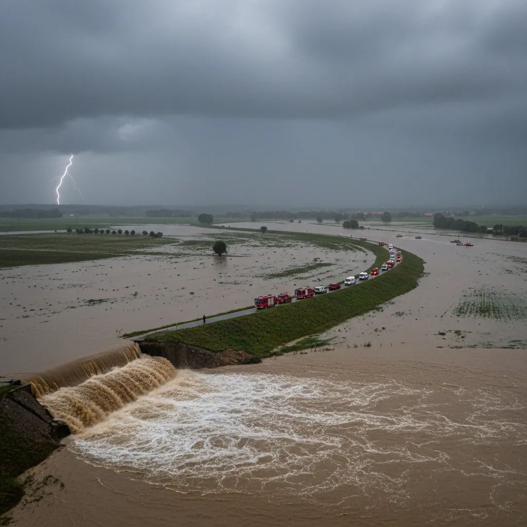
• Infrastructure failure: Dikes along the Mondego River ruptured in February 2026, flooding communities and collapsing sections of the A1 motorway, Portugal's main north-south artery.
• Multi-billion-euro redesign ahead: The Agência Portuguesa do Ambiente (APA) has commissioned an urgent technical review to overhaul the Mondego Basin's flood management system, with European funding potentially available for climate adaptation.
The Numbers Behind the Crisis
The scale of rainfall defies easy comparison. Between late October and mid-February, Coimbra's weather station logged 1,238 mm—more than four feet—of rain, eclipsing a record that had stood for six decades. The Portuguese Sea and Atmosphere Institute (IPMA) confirmed the figure represents the wettest opening to a hydrological year since records began.
Pimenta Machado, president of the APA, described the situation as "exceptional," with three weeks of relentless precipitation beginning January 28 overwhelming the basin's two primary reservoirs. The Aguieira Dam cycled through its entire storage capacity multiple times, while the smaller Fronhas Dam turned over its volume several times. During the peak stress period in mid-February, discharge rates reached critical levels to prevent an uncontrolled breach.
When the Dikes Gave Way
The system's breaking point arrived in mid-February, when a section of the right-bank dike near Casais, Coimbra, ruptured under flows exceeding 2,100 m³/s—beyond the 2,000 m³/s design threshold set when the infrastructure was built in the 1980s. The breach collapsed a stretch of the A1 motorway and triggered evacuations from low-lying areas. A second rupture downstream at Granja do Ulmeiro (Soure) transformed the Lower Mondego floodplain significantly, with widespread flooding affecting agricultural and residential areas.
Machado noted the geographic echo: in 2001, when the dike failed on the left bank with flows of just 1,700 m³/s, the rupture occurred at nearly the same location but breached toward populated areas, creating what he termed a "more vulnerable situation." The 2026 failure tore toward the right bank—agricultural land—but the symmetry is haunting. Sixteen dike breaches in 2001 displaced hundreds and submerged half of Montemor-o-Velho; the new failures suggest that quarter-century of supposed improvements barely moved the needle.
What This Means for Residents
For those living in the Mondego River Basin—spanning Coimbra, Soure, and Montemor-o-Velho—the immediate aftermath involves provisional repairs and a long wait for permanent solutions. The APA completed emergency consolidation work on the A1 embankment, restoring the motorway to service, and is now draining flooded agricultural land while stabilizing the dike breaches.
But the deeper implication is a fundamental redesign of the basin's hydraulic architecture. The Ministry of Environment and Energy has tasked the Order of Engineers with producing a comprehensive technical report on the 2026 floods, including a review of the entire risk-management model. Preliminary plans call for:
• Taller, reinforced dikes along the Lower Mondego
• Supplementary retention basins upstream to absorb peak flows
• A new upstream control dam—possibly the long-debated Girabolhos Dam—to regulate extreme discharge events
• Digital monitoring systems integrating real-time rainfall, snowmelt, and soil saturation data
The APA president emphasized that the current system was "designed for a climate that no longer exists." Historical data bears this out: Portugal has experienced four exceptional precipitation peaks in the past 25 years—2001, 2016, 2019, and 2026—a frequency unimaginable when the Mondego project was conceived.
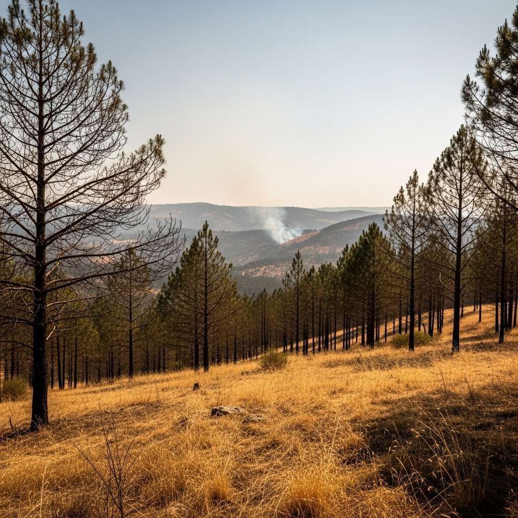
The Wildfire-Flood Nexus
One factor complicating the 2026 crisis was the legacy of summer wildfires. Machado confirmed that burned watersheds upstream shed water faster, increasing runoff velocity and peak flows. Additionally, charred timber and debris clogged critical infrastructure, including siphons near the A1, preventing them from functioning as designed.
"I am now asking the scientific community to evaluate how these siphons can perform in a completely different situation," Machado said, referring to the unexpected volume of burnt wood that overwhelmed drainage channels.
The Serra da Estrela snowpack added another variable. Warm spells in early February triggered rapid snowmelt, compounding the rainfall and surging discharge rates. The technical review will specifically examine the contribution of snowmelt to peak flow, a factor not originally modeled in the 1970s-era design.
European Precedent and Funding
Portugal is hardly alone in confronting the hydraulic consequences of climate change. Across Europe, countries are retrofitting flood infrastructure designed for 20th-century precipitation patterns. Norway has reopened buried rivers in Oslo to absorb stormwater; the Netherlands has built adaptive canals in Rotterdam to redirect floodwaters; Spain is raising dams and expanding reservoir capacity along the Ebro and Guadalquivir basins.
The European Union supports member states in developing water-resilient infrastructure, prioritizing nature-based solutions, smart irrigation, and climate-proofed systems. The strategy emphasizes climate adaptation financing for qualifying projects.
Portugal's government intends to submit the redesigned Mondego project to Brussels for evaluation, positioning it within European funding frameworks. If approved, the overhaul could unlock substantial European climate adaptation grants, offsetting domestic costs and accelerating timelines.
What Comes Next
The Order of Engineers is expected to deliver its initial findings within months, with a full technical assessment by late 2026. Public consultations will follow, engaging local councils, farmers, and industrial stakeholders in what officials describe as a "co-management model" for crisis response. The goal is to move beyond top-down emergency protocols to a more participatory governance structure that reflects the lived reality of communities in the basin.
The February floods caused significant agricultural damage, with thousands of hectares of rice paddies, vegetable plots, and pastureland affected. Insurance payouts and disaster relief will help cushion impacts, but the long-term viability of low-lying farmland is now a central policy question. Some experts advocate managed retreat—buying out flood-prone parcels and converting them to wetlands—while others push for higher dikes and expanded pumping stations.
For residents in riverside parishes, the debate is existential. Many have seen two catastrophic floods in a single generation. The 2001 disaster left deep psychological scars across the region; the 2026 event displaced thousands and created widespread hardship. The question now is whether Portugal will invest in resilience before the next record falls—or wait for another dike to fail.