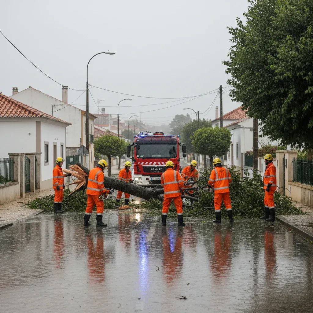
The Portugal National Authority for Emergency and Civil Protection (ANEPC) has logged more than 250 weather-related incidents during the latest overnight period, a surge that is already slowing early-morning trains, flooding suburban roads and raising insurance claims from Porto to Setúbal.
Why This Matters
• Commuter delays: fallen trees and minor landslides forced temporary closures on the Linha de Cascais, Linha do Douro and several A-class motorways.
• Homeowners on alert: more than 550 houses reported roof or water-damage claims since Monday; insurers may activate fast-track payouts but excess fees still apply.
• Persistent risk window: meteorologists expect heavy rain, coastal swell and snow in higher altitudes through at least 7 February, extending disruption to the end of the working week.
From Lisbon to Lezíria do Tejo: What Happened Overnight
Lisbon’s metropolitan area bore the brunt, with 33 call-outs between midnight and 7 a.m. The Península de Setúbal followed with 26 incidents, mostly blocked drains and toppled advertising panels. North of the Tagus, crews in the Médio Tejo district were called to clear the EN2 after an uprooted oak blocked both lanes. Although the headline figure tops 250, ANEPC stresses that no life-threatening situations occurred overnight—an improvement on last week’s storm Kristin, which left five fatalities.
Why the Numbers Keep Climbing: Inside Depression Leonardo
The current system—nicknamed Depression Leonardo—entered Portuguese airspace on 3 February and is forecast to linger until Sunday. IPMA modelling shows cumulative rainfall between 150 mm and 250 mm for mountainous areas in the North and Centre, the kind of totals usually seen over an entire month. Offshore, buoy data recorded individual wave heights peaking at 11 m on the western seaboard, justifying orange alerts for maritime activity.
Response on the Ground
ANEPC shifted the national coordination centre to continuous watch, mobilising 18 000 personnel, 6 000 vehicles and military engineering brigades for debris clearance. Local protection units have been supplied with **roof-repair kits—tiles, tarps, fast-curing cement—**to offer same-day fixes where possible. Psychologists from the national crisis roster remain on standby after a spike in anxiety calls during last week’s blackouts.
What This Means for Residents
Property owners should photograph damage before repairs to speed up claims with Seguradoras de Portugal. Expect temporary 30 km/h limits on exposed bridges, especially the 25 de Abril Bridge and the Arrábida stretch, where wind gusts may exceed 90 km/h. Rural commuters in Guarda and Bragança should check municipal feeds before setting off; school transport has already been pulled in several hilltop villages due to expected snowfall. Urban dwellers are urged to clear gutters and fasten loose rooftop items—municipal fines for objects blown onto the public way can reach €2 000, roughly a month’s rent in central Lisbon.
Looking Ahead: Forecast until the Weekend
IPMA foresees the most intense rain bands crossing mainland Portugal late Thursday into Friday, followed by a cold snap that could drop snow to 900 m. Coastal swell of 5–6 m significant height persists, with occasional 12-metre peaks. Authorities reiterate classic guidance—avoid non-essential travel, steer clear of sea walls, and never attempt to drive through floodwater. The good news? High-pressure ridging from the Azores is projected to weaken Leonardo by Sunday night, potentially restoring calmer conditions in time for Monday’s commute.