The Portugal Institute for Sea and Atmosphere (IPMA) has warned that another week of above-normal rainfall is on the way, a forecast that could translate into fresh river flooding and travel headaches just as many residents are still repairing roofs from January’s storm barrage.
Why This Matters
• Persistent rain 9–15 February will add up to 250 mm in the North and Centre—roughly a month’s worth in five days.
• Orange flood alerts already cover eight river basins; home-insurance claims may rise again.
• Commuter rail and A1 motorway have scheduled precautionary slow-downs; expect longer journeys.
• Reservoirs topping 80 % capacity reduce drought risk but raise concerns about controlled dam releases.
Weather Outlook for 9–15 February
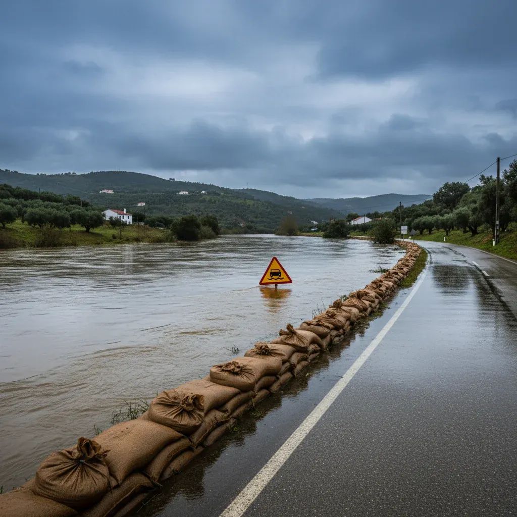
IPMA’s latest ensemble models place mainland Portugal under the western flank of Depression Leonardo, steering a conveyor belt of moist Atlantic air across the territory. The agency projects 90–250 mm of cumulative rain in districts north of Coimbra and up to 160 mm in parts of the Tagus valley. Snow is likely above 1 300 m in Serra da Estrela, while coastal areas face waves exceeding 6 m, with peak heights touching 13 m during spring tides.
Meteorologists note that surface soils are already saturated after what IPMA classified as a “very wet January.” Every monitoring station surpassed the 1991–2020 monthly average; 40 % logged 2.5–3.5 × the normal totals. With the ground unable to absorb more water, even moderate showers could quickly translate into flash floods.
What This Means for Residents
Residents in flood-prone towns such as Esposende, Pombal, and Tomar should keep sandbags handy and move valuables above ground level. The Portugal Civil Protection Authority has placed rapid-response crews near the Ave, Douro, and Lis rivers where banks overtopped last month. Motorists can expect:
• Speed restrictions on the A1, A29, and IP3 whenever gusts exceed 80 km/h.
• Possible line suspensions on the Porto–Braga and Beira Baixa rail corridors during the heaviest downpours.
• Flight diversions at Porto’s Sá Carneiro Airport if cross-winds surpass 45 knots.
Homeowners who filed storm-damage claims in January are advised to photograph any new incidents promptly, as insurers have tightened reporting windows to 5 days after an event.
Why the North and Centre Are in the Crosshairs
The Azores High remains displaced westward, creating a direct corridor for mid-latitude cyclones. Experts at the University of Lisbon’s Geophysics Institute say the jet stream has parked unusually far south, allowing a “storm train” effect: Leonardo will be followed by at least one additional low-pressure system before mid-month.
Water Reserves Get a Boost—But at a Cost
On the upside, the deluge has filled strategic reservoirs: Alqueva sits at 87 % and Alto Lindoso at 92 %. Hydroelectric operators anticipate an early start to spring generation, potentially easing electricity prices. Farmers in the Alentejo welcome the replenished soil moisture, yet vineyard owners in the Douro warn that prolonged waterlogging could foster fungal diseases.
Are Extreme Storms Becoming the New Normal?
Climatologists stress that a single season cannot prove climate change, but they agree that warmer ocean temperatures inject more energy into Atlantic lows. “Fewer storms, but stronger ones” is how IPMA researcher Sofia Batista summarises the trend. Urban planners worry that impermeable paving and drainage bottlenecks—especially around Lisbon’s eastern suburbs—are amplifying flood losses.
How to Track Alerts in Real Time
Residents can subscribe to IPMA’s push notifications, while the Proteção Civil app issues geolocated evacuation orders. For English-language updates, the European Flood Awareness System (EFAS) provides river-surge projections 48 hours ahead. Local councils from Viana do Castelo to Leiria are also streaming road closures on their municipal websites.
Quick Checklist
Clear gutters and secure loose rooftop tiles before Sunday night.
Avoid parking under riverside plane trees prone to toppling in saturated soils.
Keep a flashlight, battery bank, and waterproof ID copy ready in case of power cuts.
The coming week may not match the violence of late January’s Sting-Jet Kristin, yet the cumulative water load could prove equally disruptive. Staying alert—and dry—will be half the battle.