
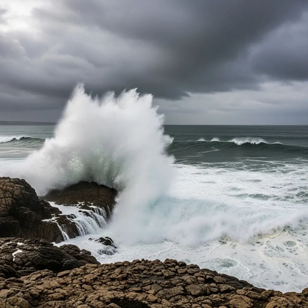
The Portuguese Institute for Sea and Atmosphere (IPMA) has placed all nine islands of the Azores archipelago under a yellow weather alert for heavy rainfall, with staggered timing across the three island groups through the weekend. Residents and visitors should prepare for occasional downpours that may disrupt outdoor activities and transportation.
Why This Matters:
• Flores and Corvo (Western Group): Alert active from 20:07 local time Friday until 07:00 Saturday
• Faial, Pico, São Jorge, Graciosa, and Terceira (Central Group): Alert in effect Saturday from 08:00 to 17:00 local time
• São Miguel and Santa Maria (Eastern Group): Alert begins Saturday 17:00 and lasts until Sunday 08:00
• Yellow alerts signal weather-dependent activity risks, though conditions remain manageable for most residents
Timing Varies Across the Archipelago
The IPMA issued the warnings in phases to reflect the storm system's trajectory from west to east. The Western Group islands of Flores and Corvo entered the alert zone first, experiencing the initial burst of precipitation overnight Friday into early Saturday morning.
By mid-morning Saturday, the Central Group—comprising Faial, Pico, São Jorge, Graciosa, and Terceira—will face the heaviest rainfall, with the alert window extending through the afternoon. Finally, the Eastern Group islands of São Miguel and Santa Maria will encounter the system later Saturday evening, with conditions expected to persist until Sunday morning.
For Ponta Delgada on São Miguel, forecasters predict light rain throughout Saturday, with a 45% probability during the day rising to 65% overnight. Temperatures will hover between 12°C and 15°C. By Sunday, skies should clear somewhat, with only a 20% chance of precipitation during daylight hours.
Understanding the Yellow Alert System
The yellow alert represents the least severe of three warning levels used by the IPMA. It is triggered when weather conditions pose a risk to activities dependent on meteorological stability—such as maritime transport, agriculture, and outdoor tourism—but do not yet threaten life or property on a large scale.
What Azores Residents and Visitors Should Do
To prepare for this weekend's rainfall, take the following practical steps:
For All Residents:
• Secure loose outdoor items, flowerpots, and garden furniture that could be damaged or displaced by wind
• Check that gutters and drainage systems are clear to prevent water pooling
• Charge phones and portable power banks in case of temporary power disruptions
• Stock up on essentials, as some local businesses may have reduced hours during the alert periods
Island Group-Specific Considerations:
• Western Group (Flores, Corvo): Prepare Friday evening before alerts begin; expect the heaviest activity overnight into Saturday morning
• Central Group (Faial, Pico, São Jorge, Graciosa, Terceira): Saturday will be the wettest day; plan indoor activities during the 08:00–17:00 alert window
• Eastern Group (São Miguel, Santa Maria): Prepare Saturday afternoon and evening; weekend plans may need adjustment through Sunday morning
For Ferry and Air Travel:Contact your transport provider directly to confirm schedules, as inter-island ferries may experience delays or cancellations during peak rainfall hours. Flights are less frequently disrupted by yellow alerts, but check with airlines for updates.
For Outdoor Activities and Tourism:Hiking trails and coastal viewing areas may be temporarily unsafe during the alert periods. Book indoor attractions or reschedule outdoor excursions to Sunday afternoon or Monday when conditions are expected to clear.
Where to Get Updates:
• IPMA website and mobile app for real-time weather updates
• Azores Regional Government Civil Protection for official emergency information
• Local radio stations for regular weather briefings
• Emergency services: Dial 112 for urgent situations
Why This Matters in the Broader Context
Extreme weather events like this yellow alert underscore the importance of preparedness for all residents across Portugal, including the Azores. Recent devastating storms on the mainland—Kristin, Leonardo, and Marta in January and February—claimed 19 lives and caused billions of euros in damage, with over half the deaths occurring during recovery operations. These events demonstrate that even manageable weather alerts require serious attention to prevent accidents and minimize disruption.
The storms also exposed a critical gap in Portugal's disaster preparedness: only about 25% of buildings carry catastrophe insurance coverage, leaving most reconstruction costs to families, businesses, and the state. The Portuguese government is now actively developing mechanisms to encourage wider adoption of disaster insurance and is establishing a National Catastrophe Fund to cover gaps in private coverage. All Portuguese residents, including those in the Azores, should consider comprehensive disaster insurance as essential protection.
Final Advice
The Azores yellow alert this weekend is manageable for most residents and visitors who take basic precautions. Monitor IPMA updates as the system moves across the islands, stay informed, and secure your surroundings. By Sunday, conditions should improve significantly, and normal activities can resume. Safe weather to all.


