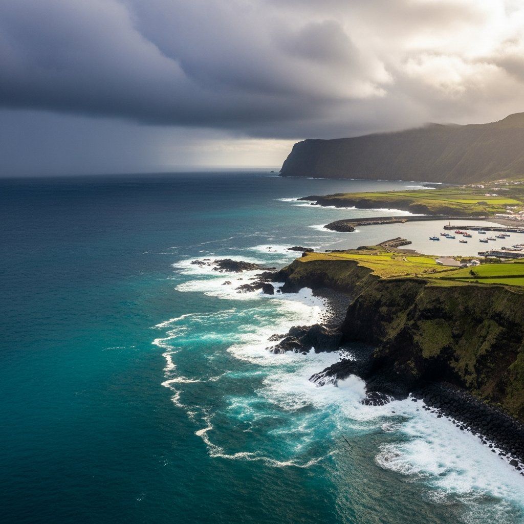
Heavy skies over the mid-Atlantic have finally opened up to calmer weather, yet the Central Group of the Azores—Faial, Pico, São Jorge, Terceira and Graciosa—spent much of November under repeated yellow alerts. Islanders can breathe a little easier for the moment: the IPMA dashboard now shows green, meaning no warnings in force. Even so, the month’s chain of downpours has reminded residents, authorities and travellers that the tropical corridors feeding the archipelago rarely stay quiet for long.
At a glance
The change from alert to tranquillity arrived late on Friday after several rounds of rain that peaked on 26 November. Over the past weeks the region faced strong squalls, visibility drops, occasional thunder, and the usual juggling of flight schedules, inter-island ferries and everyday chores. Regional civil protection urged people to reinforce roofs, clear drains and secure garden items, while maritime and air operators braced for timetable hiccups. Climatologists observing these events point to a wetter, storm-prone future under global warming, but also highlight fresh investments—most notably the new weather-radar network—that aim to catch trouble sooner.
The roller-coaster of November skies
Stories from the islands read like chapters in a novel of alternating calm and fury. Mid-month, just as São Martinho celebrations were winding down, a vigorous Atlantic front swept in on 15 November with enough punch for IPMA to trigger the first yellow precipitation warning of the season. Less than two weeks later, another atmospheric river travelled east, drenching the same five islands from dusk on the 26th into the following afternoon; rainfall totals briefly threatened local records before the system slid away. October had already set the tone when a broad convective mass arrived on the 6th, coupling rain with sporadic lightning and underlining how frequently the Central Group sits in the cross-hairs of mid-latitude cyclones. Meteorologists noted that each successive burst formed slightly farther south, a sign of the shifting storm tracks that researchers have been mapping since the late 1990s.
How the islands coped on the ground
Islanders know that a yellow notice is the mildest tier, yet preparation remains crucial. In many parishes neighbours checked insurance clauses for so-called “phenomena of nature”, tightened loose roof tiles, cut ageing branches and swept leaves away from gutters before the water arrived. Local volunteers recalled towing a stranded rental car from a rural road on Pico after a sudden cloudburst turned gravel to mud. On Terceira, firefighters kept portable pumps ready near the historic Angra old town, whose narrow streets can funnel run-off toward basements. Civil protection officials praised the public’s “growing risk culture”, pointing to the near absence of injuries this month as evidence that repeated drills and text-alert campaigns are paying off.
Planes, ferries and the delicate dance with Atlantic storms
Transport managers played their own waiting game. SATA Air Azores held aircraft on the ground more than once while intense cells passed overhead, delaying crews —but avoiding costly diversions to Madeira or Lisbon. Harbourmasters at Horta and Praia da Vitória warned skippers to expect reduced visibility; a handful of evening sailings were scrubbed, though cargo links essential for supermarket shelves largely continued. The Port of São Roque saw brief closures of its bar on two mornings, underscoring the fine line between routine disturbance and serious disruption under a yellow bulletin. Passengers showed patience; most are seasoned enough to pack a spare jumper and a flexible itinerary whenever November appears on the calendar.
Scientists see a bigger picture
Climatologists observing the Azores draw a straight line between these wetter episodes and wider Atlantic warming trends. Ricardo Deus of IPMA argues that “subtropical moisture conveyors” are now unlocking more heat energy as they travel, delivering heavier bursts over the islands. Geophysicist Filipe Duarte Santos notes that historical odds of a hurricane-class system brushing the archipelago have doubled since the 1980s. A widely cited peer-reviewed study released this year estimates an additional 1.4 days of very heavy rainfall per annum by 2100 under high-emission scenarios. Local officials recall the €330 M bill from Hurricane Lorenzo in 2019 whenever the debate turns to prevention, seeing the new radar chain—covering the western, central and eastern groups—as a cornerstone for smarter evacuation plans and real-time flood mapping.
What comes next for residents and authorities
Weather model runs suggest a quieter opening to December, but forecasters caution that maritime lows spinning off the Eastern Seaboard can reach the Azores within three to five days. Authorities intend to keep public messaging sharp, favouring early advisories over late-night sirens. Homeowners are encouraged to continue the seasonal chores their grandparents practised—clearing stone channels, inspecting attic beams—while policymakers eye longer-term questions such as relocating critical infrastructure away from flood-susceptible zones. In the meantime the islands enjoy a reprieve: cafés in Horta have reopened terrace seating, hikers are back on Pico’s caldeira trails, and one uncomplicated fact remains true—the next Atlantic squall is never more than a horizon away, and the archipelago’s readiness will be tested again soon.


