
The next Atlantic system moving across the Iberian Peninsula is set to test Portugal’s winter readiness, bringing a cocktail of strong wind, heavy rain, mountain snow and a powerful swell that could rival the worst days of last season.
At a glance
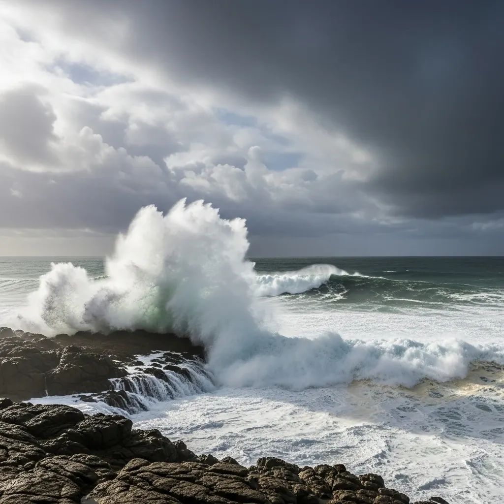
• 10-metre Atlantic waves expected along exposed stretches of the west coast
• Gusts topping 90 km/h likely from Lisbon northward during frontal passage
• Snow above 700 metres could disrupt traffic in Serra da Estrela and Trás-os-Montes
• Urban flooding risk elevated in Porto, Aveiro and parts of the Algarve during intense downpours
Where and when the weather turns nasty
Portugal’s meteorological service, IPMA, has placed most mainland districts under orange or yellow warnings as the centre of the depression, unofficially dubbed Ingrid by northern-European weather agencies, brushes past Cape Finisterra. Coastal communities between Viana do Castelo and Peniche will feel the first punches early in the morning, with the storm line sweeping south and clearing the Algarve by the following dawn. Central highlands may see accumulations of 5-15 cm of fresh snow, while river valleys from the Douro to the Tejo face short but torrential bursts of rain.
Expect transport headaches
Rail operator CP is preparing speed restrictions on the Minho and Beira Alta lines, and the national road authority has warned of possible closures on the A24 near Vila Real if snow sticks. Porto and Lisbon airports anticipate delays for European flights, and inter-island links in the Azores have already been pre-emptively cancelled by SATA due to the forecast swell. Urban commuters should budget extra time on Monday evening as strong cross-winds may force speed caps on the Vasco da Gama and Luís I bridges.
Safety tips from authorities
The Autoridade Nacional de Emergência e Proteção Civil urges residents to secure loose objects on balconies, stay clear of breakwaters when waves peak, and keep emergency torches handy for potential power cuts inland. Mountain drivers are advised to carry snow chains, and fishermen have been told to avoid setting out until the sea state drops below 4 metres significant height, which may not occur before mid-week.
Putting Ingrid in perspective
Although far from the destructive power of Storm Leslie in 2018, Ingrid is expected to be the first multi-hazard event of 2026. Climatologist Mário Marques notes that the string of rapid-fire depressions now lining up in the Atlantic is typical of a La Niña winter, when the jet stream tends to park just north of Madeira and funnel storms toward Portugal every 48-72 hours. Sea-surface temperatures remain 1 °C above normal, adding moisture to the system and raising the odds of short-lived, high-intensity downpours.
What happens after the front passes
Current models suggest a brief lull mid-week before yet another low forms southwest of the Azores, threatening to deliver a second round of heavy rain next weekend. For now, IPMA advises citizens to monitor updates through the agency’s smartphone app and local radio. As with every winter storm, common-sense preparation—clearing drains, checking roof tiles, and mapping out alternative routes—can make the difference between inconvenience and costly damage.


