After a summer that felt more sub-Saharan than Atlantic, Portugal is bracing for a sudden pivot to soggy, cool weather. Meteorologists warn that a vigorous frente fria—the first of the young autumn—will sweep ashore Saturday night, lashing the northern coast before rolling south and east through Sunday. The change means umbrellas, sweaters and some travel patience should top every expat’s weekend checklist.
Rapid switch to autumn across Portugal
Climatologists at the IPMA say the frontal system being steered toward the Iberian Peninsula by a depression northwest of Galicia will bring persistent rain, gusty Atlantic winds, sharply lower highs, and street-level flooding risks. Although Portugal’s long dry spell has primed soils to soak up moisture, the agency stresses that burnt hillsides in the Centro and Minho could see runoff, small landslides, and mud-choked roads. In practical terms, residents should expect a Saturday evening of on-again, off-again showers north of Porto, followed by a country-wide soaking by dawn on Sunday.
Where and when the rain will hit
IPMA forecast models show the most intense downpours between midnight and late Sunday morning along the Porto–Aveiro–Coimbra corridor. As the front migrates inland, river valleys from the Douro to the Mondego may receive 20-30 mm in a few hours—enough to trigger yellow alerts for flash-flood-prone urban zones. Lisbon is likely to feel the first drops near sunrise, with scattered showers lingering through the afternoon. The Algarve, often spared autumn’s early tempests, is not exempt this time; light to moderate rain should cross Faro by dinner.
Temperatures tumble: likely impacts on daily life
Sunday’s mercury will struggle to top 23-27 °C, a 6-10 °C plunge inland and a 3-6 °C slide along the coast compared with Saturday. For newcomers accustomed to Portugal’s near-perpetual warmth, the drop can feel abrupt—air-conditioning gives way to dehumidifiers, cafés swap iced coffees for meia de leite quente, and beach plans turn into museum outings. Power grids usually handle these swings, but old rental flats without adequate insulation can feel damp; a portable heater may be worth the €20 investment.
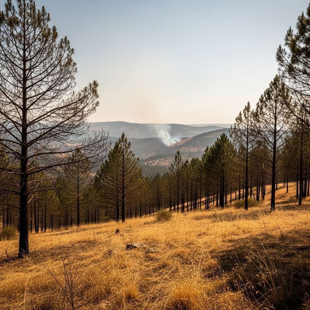
Civil protection on alert after record dry summer
The Autoridade Nacional de Emergência e Proteção Civil has issued a pre-emptive warning because scorched terrains left by this year’s severe wildfires lack vegetation to anchor soil. That means rainwater will rush downhill, carrying ash, rocks, and sometimes contaminants into water supplies. Drivers could encounter tree branches, construction debris, or slick patches on the A1 and A3 motorways during the worst showers. Municipal crews spent Friday unclogging drains and urging residents to clear balconies and guttering, but authorities still urge defensive driving and a low-speed approach when water pools on cobblestones.
A pattern repeated: climate backdrop
While early-September fronts used to be gentle harbingers of autumn, scientists see the current system as another sign of growing climate volatility. Portugal just logged its hottest and driest summer since 1931; swings to cooler, wetter conditions often become more violent after such heat stress. Meteorologist Vanda Pires explains that a meandering jet stream—distorted by warming Arctic air—can pull cold North Atlantic air farther south, energising the clash between air masses. The resulting storms pack heavier rainfall even as overall precipitation trends downward over the long term.
How to prepare if you’re new in town
Seasoned locals treat the first big front as a rehearsal. Have a compact umbrella, waterproof shoes, and microfibre towels ready by the door. If you live in a historic quarter like Alfama or Ribeira, verify that building managers cleared roof tiles and drainage spouts; centuries-old architecture is charming but prone to seepage. Keep an eye on the IPMA app’s radar loop—updated every 10 minutes—and sign up for ANEPC SMS alerts. Most supermarkets stock sandbags and plastic sheeting near the checkout this time of year; even one bag placed at a doorway can block sudden sidewalk streams.
Forecast beyond Wednesday: should you cancel plans?
IPMA’s medium-range charts suggest successive, weaker fronts will brush the North and Centre until at least mid-week. Daytime highs should hover in the mid-20s, edging toward normal by Thursday. Sun seekers planning a Douro vineyard tour on Tuesday might encounter fog and drizzle at sunrise but brighter skies by noon. Beach holidays in the Algarve face only minor interruptions. Airlines and rail operators have not announced disruptions, yet low-cost carriers occasionally adjust schedules when Porto’s runway visibility drops, so monitor notifications. If your relocation calendar includes a Monday driving test or citizenship appointment, allow extra travel time—and carry that umbrella just in case.