
Portugal woke up to battered coastlines, toppled power lines and a collective sense of déjà-vu after Storm Kristin barrelled across the mainland overnight, unleashing hurricane-force gusts and the year’s first red-level weather emergency. While the worst of the system is already east of the country, civil-protection officials insist the episode is not over: lingering flood risks, disrupted transport and the possibility of new Atlantic depressions keep the alert level high.
At-a-Glance: What residents should know now
• Five confirmed fatalities and dozens injured, mainly in the Centre region
• Peak gust of 176 km/h recorded at Monte Real air base, breaking a national record
• More than 200,000 customers experienced power cuts; most but not all have been re-connected
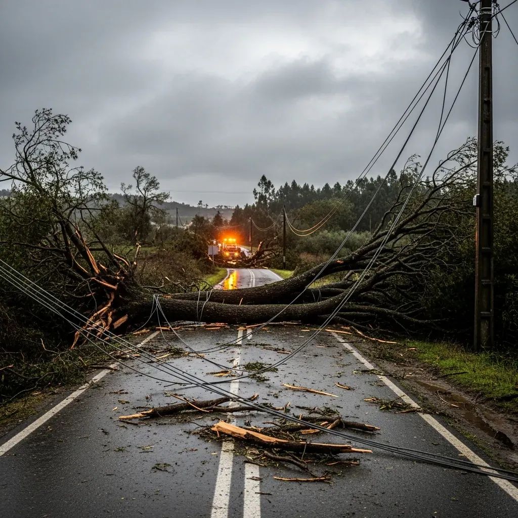
• Rail and A1 motorway still face partial closures for debris clearance
• Yellow rain alerts remain for 11 districts; snow expected on the Serra da Estrela crest
• Authorities warn that two further Atlantic lows could approach early next week
A night of alarming numbers
Between midnight and dawn the barometer plummeted by almost 30 hPa, a textbook case of “explosive cyclogenesis.” That free-fall in pressure translated into savage winds: 140 km/h along the Douro coastline and 176 km/h inland at Monte Real. Torrential bands dumped more than 70 mm of rain in six hours over the Vouga basin, swelling rivers that were already near capacity after a wet January. The Portuguese Institute for the Sea and Atmosphere, IPMA, hoisted a red warning for wind and coastal swell from Viana do Castelo down to Setúbal, the highest tier of the alert scale.
Epicentre in the Centre: damage and victims
The first daylight surveys put Leiria at the heart of the destruction. The city’s fire chief counted "hundreds" of downed trees, smashed rooftops and power pylons "twisted like paperclips." Tragically, three residents there—among them a 28-year-old São-Toméan woman who had arrived in Portugal only a fortnight ago—lost their lives when masonry collapsed. Another death occurred in Vila Franca de Xira after a vehicle was struck by falling debris, and a fifth victim was confirmed in Marinha Grande. Nationwide, more than 1,800 incidents were logged by Proteção Civil. Electricity distributor E-Redes said that by mid-afternoon it had restored supply to 85 % of the 200,000 affected households, but warned that remote valleys might remain dark into the evening.
The science behind Kristin’s punch
Meteorologists describe Kristin as a classic North-Atlantic mid-latitude cyclone but with an added "sting-jet"—a narrow, very fast airstream tucked behind the storm’s cold front. When that jet dips toward the surface it can add 60-80 km/h to already dangerous winds. IPMA climatologist Ricardo Deus likened the mechanism to a “power-drill boring through the atmosphere,” a process also seen in the infamous Hurricane Leslie (2018). Researchers caution that while any single storm cannot be blamed on climate change, a warming ocean tends to feed more moisture and energy into these systems, increasing the odds of extreme wind events.
What happens next
Satellite loops show Kristin racing into Castile, allowing pressure to rebound over mainland Portugal. Even so, yellow alerts for persistent rain cover 11 northern and central districts, and the Serra da Estrela is bracing for a fresh dusting of snow above 1,600 m. Maritime authorities have downgraded coastal swell warnings from red to orange and now yellow, but advise against cliff walks or surfing until seas fall below 4 m. Meteorologists are tracking two additional lows nearer to the Azores; their trajectories remain uncertain but could spell another period of gales early next week.
A brief look back—and forward
Kristin is the fourth storm in a decade to deliver gusts exceeding 140 km/h on Portuguese soil, joining Leslie (2018), Elsa (2019) and Aline (2023). Municipalities now race to tally costs; Leiria’s mayor calls the bill "incalculable" and warns of a year-long rebuild. The Interior Ministry says disaster-relief funds will be activated once local audits finish. Urban planners meanwhile face the broader question of how to harden infrastructure against the increasing volatility of Atlantic weather systems.
Staying safe and informed
Residents can monitor fresh alerts on the Prociv mobile app, follow IPMA bulletins and dial 112 only for life-threatening emergencies. For road conditions consult Infraestruturas de Portugal’s website and, if travelling by train, CP’s real-time updates page. The Proteção Civil reiterates three basic rules:
Secure loose objects on balconies and patios.
Avoid wooded areas during high-wind periods.
Do not drive through flooded roads—water depth and current are easy to misjudge.
While the worst may have passed, Kristin’s legacy is a fresh reminder that the Atlantic can still hurl winter systems with near-tropical ferocity toward the Iberian Peninsula. Remaining vigilant—and learning from every storm—may be Portugal’s best defence against the next name on the meteorological list.


