
Portugal may be bracing for another weekend under grey skies, yet the story is bigger than a bit of drizzle. A parade of Atlantic depressions is locking the country into a wet pattern that will test commuters, farmers and anyone planning an outdoor gathering through the final days of January.
In short: widespread rain on both Saturday and Sunday, a brief lull here and there early next week, and another pulse of heavy showers by mid-week.
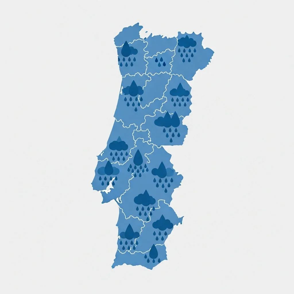
Quick glance at what matters now
• Lisbon & Tagus Valley: rain dominates the weekend, peaks again Monday; thermometers hover around 15-16 °C.
• Northern districts: coolest region with minima near 5 °C and the heaviest, most persistent showers.
• Centro interior: patchy sun breaks through some afternoons, but nights stay wet and gusty.
• Alentejo & Algarve: marginally warmer—highs of 16 °C—yet umbrellas remain essential.
• Azores: warmest at 18 °C but lodged beneath back-to-back squalls.
(Forecast window: Saturday 30 to Wednesday 3 February, data: IPMA)
Why is the rain refusing to leave?
Meteorologists point to three intertwined triggers:
Atlantic depressions arriving in quick succession—named storms Ingrid, Joseph and Kristin—are steering long plumes of moisture straight toward the Iberian Peninsula.
The polar jet stream has sagged unusually far south, acting like a conveyor belt for those systems.
A weakened Azores High is failing to shield Portugal, granting every low-pressure centre “free passage”.
Climatologists add that warming oceans strengthen water-vapour transport, so bouts of intense winter rain are becoming more common even though yearly totals trend downward.
Regional picture in detail
Lisbon & surrounding coast
Spells of lighter rain on Sunday morning could tempt a café run, but do not be fooled. Stronger fronts return Monday with gusts topping 60 km/h along the waterfront. By Tuesday, cloud gaps bring stray sunbeams, yet radar models keep showers swirling until at least Wednesday night.
North & Douro valley
Orographic lifting along the Minho and Gerês ranges will wring out the moisture. Expect near-continuous drizzle punctuated by heavy bursts, river levels rising and overnight lows flirting with 5 °C. Commuters on the A3 and A4 should plan for reduced visibility.
Central highlands and coastal Beira
Saturday may start brighter inland, particularly around Viseu, but post-sunset bands of rain sweep eastward. From Monday onward, 13 °C is the top daytime reading; valleys such as the Mondego could see minor flooding if predicted totals materialise.
Alentejo & Algarve
The south trades intensity for frequency: showers are shorter but rarely absent. Tuesday afternoon’s drier window could be the best chance to prune vines or walk the shoreline. Even so, evening downpours are expected to spoil sunset views.
Azores archipelago
A semi-permanent trough west of Faial keeps cloud decks thick. Daytime highs touch 18 °C, yet humidity stays above 80 %. Localised squalls on São Miguel on Monday and Tuesday could push rainfall toward 40 mm in 48 h.
What the wet spell means on the ground
Agriculture: Orchards in the Oeste and greenhouses in Ribatejo already report waterlogging after Kristin’s passage. The farming confederation has urged government surveys to quantify crop-loss compensation.
Transport: Fallen branches and surface runoff turned several national roads impassable earlier this week. With more rain on the way, the ANEPC advises avoiding forested stretches after dusk and checking railway updates before travel.
Outdoor events: Municipalities from Porto to Setúbal have cancelled or moved fun-runs, markets and concerts earmarked for this weekend. Organisers are pivoting online or seeking indoor venues until IPMA downgrades its orange warnings.
How unusual is all this?
January is statistically wet—northern Portugal averages >200 mm this month—but five named storms in a single January is well above the 30-year norm. Researchers at the University of Lisbon note that while overall annual rainfall is slipping about 20 mm per decade, the episodes that do arrive are packing greater punch, a signature most climate models attribute to greenhouse-gas-driven warming.
Tips to outsmart the weather
• Keep storm drains clear: clearing leaves prevents garden and basement flooding.
• Plan trips around mid-morning Sunday or early Tuesday, the likeliest calm slots nationwide.
• For rural residents, photograph plot damage promptly; it speeds any future insurance or state-aid claims.
• City cyclists should fit full-length mudguards—spray from cobbles is relentless.
Looking beyond Wednesday
Long-range ensemble charts hint at a modest ridge edging in from the Canaries late next week, potentially delivering a genuine break. Until models align, however, residents may wish to locate that spare pair of wellies and keep them by the door.


