A strong Atlantic front rolls toward Portugal this weekend, promising frequent showers, a brief cold snap in higher ground and a yellow alert for rough seas along parts of the west coast. While Saturday looks damper, models hint at sunnier breaks on Sunday—just in time for many to take advantage of the long 1-8 December bank-holiday stretch.
Quick glance at what to expect
• Wettest spots: Minho, Douro Litoral and the Serra da Estrela slopes
• Sun-window: Late Sunday afternoon, especially south of the Tagus
• Thermometers: Generally 12-18 °C on the mainland; Madeira climbs to 21 °C-23 °C
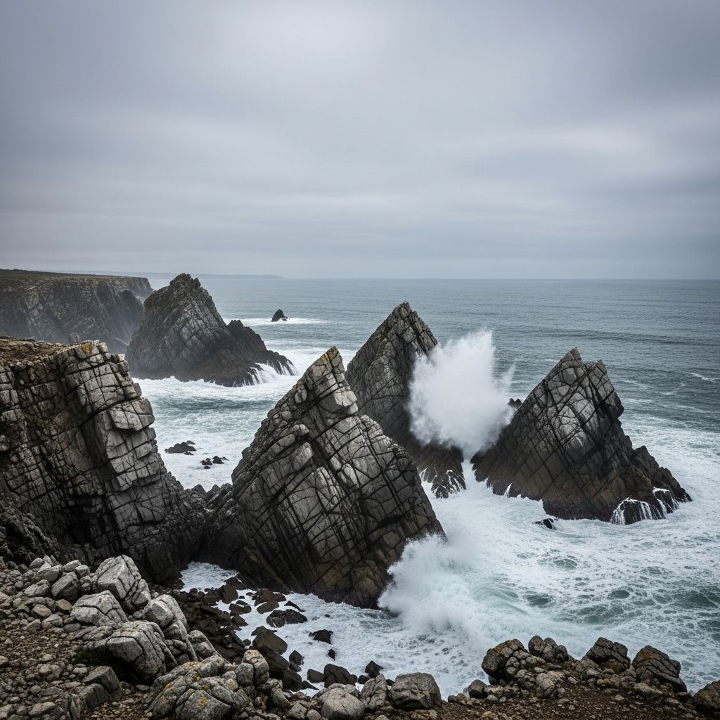
• Wind & waves: Northwest gusts up to 50 km/h along exposed coasts; 3-4 m swell triggers the IPMA’s yellow sea-state warning
• Snowline: Could dip to 1 400 m overnight in the central mountains
Why this weekend’s weather deserves your attention
Portugal normally sees more than 20 rainy days in December, but the last few years have trended drier. This Saturday and Sunday reverse that pattern briefly: an active cold front on Saturday gives way to a post-frontal trough on Sunday, adding a risk of local flash downpours just as millions plan to travel for the 8 December public holiday.
Greater Lisbon and surrounding coast
Clouds thicken on Friday night, ushering in persistent rain through most of Saturday. Temperatures hover between 13 °C at dawn and 18 °C mid-afternoon. Micro-climates make a difference:
• Sintra & Mafra: orographic lift squeezes out extra drizzle—pack a waterproof.
• Ericeira & Santa Cruz: pockets of sunshine could briefly appear Saturday morning, but sea-spray and strong surf are likely after lunch.Sunday brings scattered showers, then brighter skies toward dusk before another rain band arrives pre-dawn Monday.
Northern pulse: from Minho to Trás-os-Montes
The front hits the northwest first, dropping up to 15 mm in Braga and Viana do Castelo before noon Saturday. Expect:
• Highs around 17 °C on the coast, but daytime values may stall near 10 °C in Bragança by Monday.
• Snow showers possible above 1 400 m late Saturday, lowering to 1 200 m Sunday night in the Serra do Gerês.
• Road users on the A3 and A24 should watch for standing water and gusty cross-winds.
Centre in the balance
Along the Mondego and in the western Beiras, Saturday begins cloudy with patchy drizzle. Showers gain strength after lunch, peaking overnight. Maximums slip to 15 °C by Monday, while lows could touch 5 °C in valleys such as Covilhã. The Serra da Estrela ski area may record its first measurable snow of the season.
Southern respite – but don’t forget the umbrella
Alentejo and Algarve start the weekend under thick cloud. Beja and Évora could remain dry until mid-afternoon Saturday, while Faro might even see a short burst of sun Sunday midday. Yet a secondary trough drags rain back Monday and Tuesday, keeping highs near 18 °C with muggy nights around 12 °C.
Madeira: mild, unsettled and breezy
Saturday stays mostly grey with 21 °C peaks in Funchal. Sunshine makes a cameo on Sunday, but showers return Tuesday. Mid-week, an injection of subtropical air could nudge readings up to 23 °C—good news for walkers, less so for anyone counting on a completely dry levada hike.
The science behind the showers
Meteorologists at the IPMA point to a succession of Atlantic fronts sweeping in as the Azores High temporarily retreats. Behind each front, colder maritime air undercuts lingering warmth, pushing it upward and wringing out rain. In mountain zones, rapid cooling aloft means precipitation turns to snow once the freezing level slips under 1 500 m. Conversely, where high pressure rebuilds—likely over the Iberian interior on Sunday afternoon—clouds break and sunshine emerges.
Early next week: colder, wetter up north, brighter down south
Monday keeps the rain shielded north of the Tagus with daytime highs of 9-11 °C in Porto and Viseu. By Tuesday, a secondary low deepens west of Galicia, flinging fresh squalls across the mainland. Current guidance suggests a drier Wednesday in the Algarve, while Madeira basks in warmer air.
Travel and safety pointers
Check ferry and surf warnings: wave heights along the Leixões-Peniche stretch exceed 3 m; smaller craft should remain in port.
Drive cautiously on mountain passes: sleet or thin ice may appear above 1 200 m from late Saturday.
Keep a torch and extra battery pack if you’re hiking remote trails; sudden fog is common after frontal passage.
Putting it in perspective
Long-term data show December temperatures in mainland Portugal increasing about 0.3 °C per decade since the 1970s, while total rainfall is slipping. Last December ranked among the driest on record. This weekend’s bout of wet weather, therefore, is more of an exception than a return to old norms. Climate scientists caution that episodic downpours can coexist with an overall drying trend—so water managers will watch river basins closely even without formal flood alerts.
In short, keep the raincoat handy, plan for slippery cobblestones, but also leave room for surprise clear spells—especially if you’re chasing that perfect winter sunset over the Tejo or the Douro vineyards.


