Cold dawns, sudden downpours and restless seas have converged over mainland Portugal, driving the national weather service to place a swath of the country under yellow alerts. While the warning colour signals only moderate danger, the combination of icy nights in the Northeast and storm-fed coastal swells in the South demands close attention in the coming days.
Why the alert matters now
A quick glance at the updated meteorological map tells its own story: six interior districts are shivering under a minimum-temperature warning, even as eight mostly coastal districts remain on watch for rain, wind and rough surf. For residents juggling the first work week of the year, that means:
• Freezing lows that may slip to ‑4 °C in Guarda and Bragança
• Gusts topping 110 km/h over Serra da Estrela and other high ground
• Heavy showers capable of triggering urban flooding in Lisbon and the Algarve
The engine driving the turbulence
Weather desks from IPMA to private forecasters pin the instability on a vigorous Atlantic system dubbed Depressão Francis. The low-pressure centre has been funnelling polar air southward while dragging moisture-rich fronts across Iberia. The clash of a cold core aloft with sea-surface temperatures still above seasonal averages is amplifying:• Convective bursts—hence the sporadic thunder in Setúbal and Faro.• A barometric squeeze, producing the powerful southerlies lashing Coimbra, Leiria and Castelo Branco.• Rapid temperature gradients that support sleet or even snow flurries at surprisingly low altitudes around Vila Real.
Meteorologist Ricardo Tavares of Luso Meteo warns that “a barely one-degree shift could spell the difference between a rain-soaked morning commute and icy roads at dawn.”
Region-by-region snapshot
Interior Norte & Centro
The spotlight here is on persistent cold. Bragança, Vila Real, Guarda, Viseu and Castelo Branco remain under a chill advisory from midnight Monday until at least early Tuesday. Frostbite risk is minor yet real for outdoor workers.
Lisboa & Vale do Tejo
Capital commuters should brace for intermittent squalls and sudden cross-winds on the Vasco da Gama and 25 de Abril bridges. Drainage crews have been dispatched to clear leaf-clogged gutters after last week’s holiday slowdown.
Alentejo & Algarve
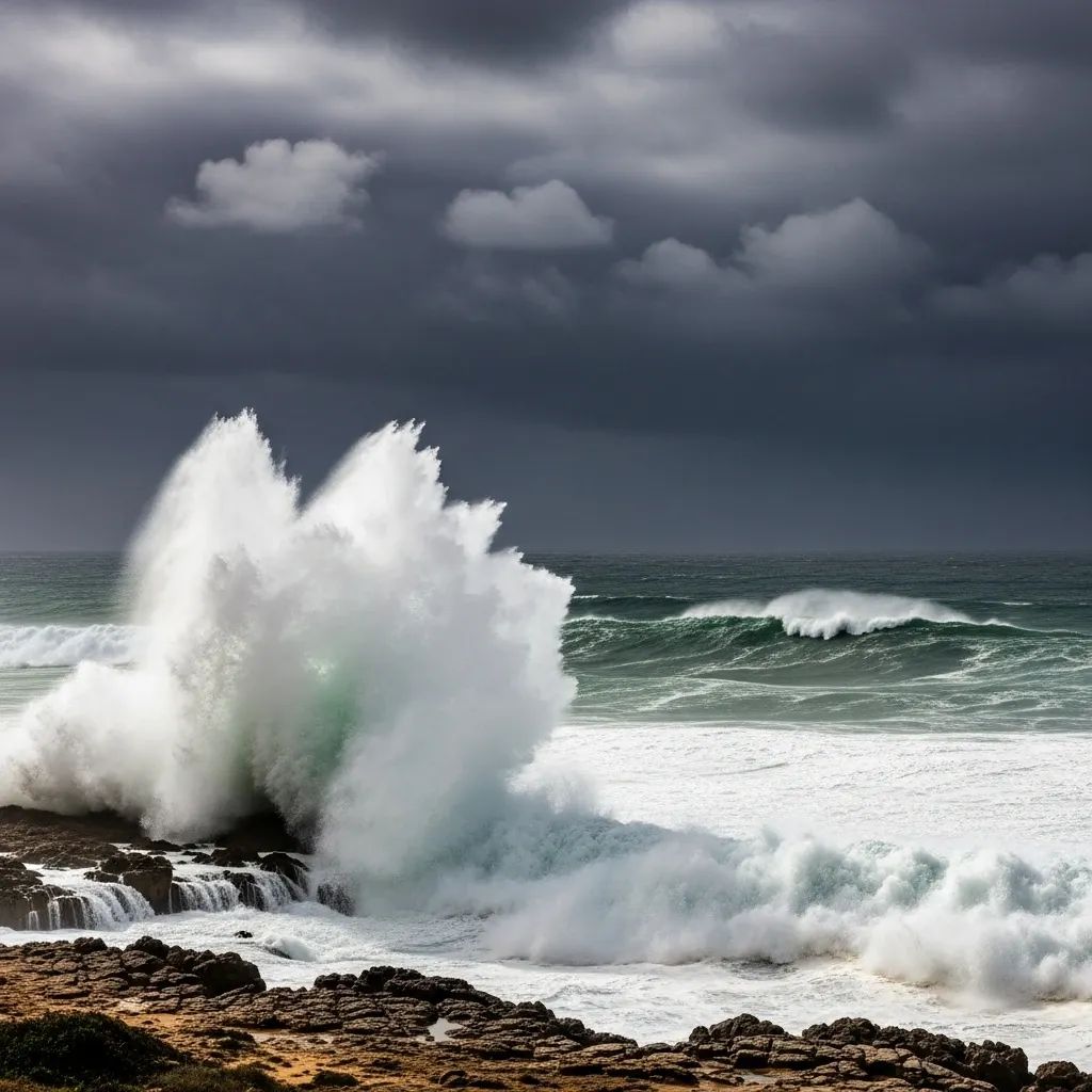
Beja and Faro confront a triple threat: bursts of torrential rain, 70-80 km/h gusts near Sagres and 2.5-4 m Atlantic rollers curling toward the south-facing beaches. Surf schools have cancelled Monday sessions; port authorities advise small craft to remain docked.
Civil-protection checklist
Portugal’s national emergency agency has revived its standard wet-and-windy protocol. The key points, adapted for household use, are worth revisiting:
Secure loose items on balconies and construction sites; windborne debris remains the top urban hazard.
Keep drainage grates clear to limit flash flooding, especially in low-lying zonas ribeirinhas.
Postpone non-essential mountain drives—stonefall on N2 and EN323 already forced temporary overnight closures.
For coastal residents, maintain a safe 50-metre buffer from breaking waves; sneaker waves have surprised beach-walkers in previous January storms.
How long will the turmoil last?
Current model runs suggest the core of Depressão Francis will slide east of Portugal by mid-week. IPMA expects:• Rain bands to weaken from north to south Tuesday night.• Temperatures to remain 1-3 °C below seasonal norms through Thursday.• A brief ridge of settled weather on Friday before another Atlantic trough possibly arrives next weekend.
Local forecasters, including the university team at Aveiro, emphasise that uncertainty remains high; minor shifts in track could sustain showers in the Algarve or trigger an encore cold snap in Trás-os-Montes.
What it means for daily routines
Commuters: build a 10-minute safety margin into morning departures; black ice has already been reported near Vilar Formoso.Parents: verify that school transport services remain on schedule—several interior municipalities have activated cold-weather plans for early bus runs.Small businesses: review insurance coverage for wind damage; January 2023 claims topped €18 M after a similar sequence of yellow-and-orange days.
The bottom line
A yellow alert rarely makes headlines, but the sheer mix of hazards—icy pavements in the north, soaking rain in the south and punchy gusts in between—demands respect. Staying informed and taking basic precautions should keep most disruptions brief and, crucially, reversible before the next Atlantic system knocks on Portugal’s door.