Rain won’t keep Christmas lights from shining, but travellers could encounter sleet-covered mountain roads, gusty Atlantic squalls and the first widespread snowfall of the season before the week is out. From the coastal avenues of Porto to the uplands of Bragança, Portugal is bracing for a lively cocktail of weather that promises postcard moments and logistical headaches in equal measure.
Quick take-aways before you plan the next drive
• Chilly nights: inland lows dipping to -3 °C in the highest plateaus.
• Intermittent showers along the litoral Norte e Centro through Monday evening, easing a little on Christmas Eve.
• Renewed rain bands and wet snow late on Christmas Day and Boxing Day.
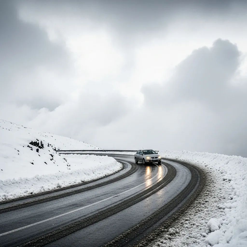
• Eight districts on watch for wintry precipitation above 800 m; pay extra attention if crossing the A24, A25 or IC5.
• Persistent north-north-westerlies may push Atlantic waves to 5 m on exposed coasts.
A stop-start weather pattern rules the holiday week
The battle between an Azores anticyclone and a Mediterranean depression is sending pulses of humid air over Portugal. That tug-of-war will deliver periods of rain, pockets of sunshine, and cold snaps strong enough to turn lingering moisture into powdery snow. Meteorologists at IPMA expect the most frequent precipitation through the early hours of Tuesday, particularly along the Aveiro–Porto–Viana do Castelo corridor. A temporary lull should arrive on Christmas Eve, giving shoppers a dry window, before a secondary frontal wave reloads the rain gauges late on Thursday.
Key drivers behind the roller coaster include: strong jet-stream undulations, cold advection from the north, and sea-surface temperature contrasts of nearly 4 °C between Madeira’s latitude and the Galician coastline. Together they make forecasting tricky—but the consensus keeps Christmas on the damp, cold side rather than stormy.
Where the white Christmas odds are highest
If you’re dreaming of snow, head above the 800/1,000-metre contour. Forecasters flag the Serra da Estrela, Montesinho, Alvão and Gerês massifs as the most likely spots to collect a fresh blanket between Monday night and Wednesday dawn. By late Thursday, the freezing line should lift slightly, restricting further flakes to the very peaks.
Expect Bragança, Guarda and Vila Real to flirt with -2 °C just before sunrise on Christmas morning. That temperature margin is enough for black ice, so keep chains or winter tyres handy if you’re venturing onto the EN232 or EN101.
How rain and snow may disrupt travel
Railways, motorways and even airport timetables all become more fragile when the weather turns this mixed. Heavy showers can produce surface flooding on the A1 and CRIL, while wet snow on mountain link-roads could prompt rolling closures by Infraestruturas de Portugal. The rail operator CP warns that saturated embankments raise the risk of landslips along the Douro and Beira Baixa lines. Meanwhile, Lisbon and Porto airports keep a close eye on low-cloud ceilings and crosswinds that sometimes divert flights to Faro or Vigo.
Staying safe and making the most of it
Authorities have not yet activated any orange-level warnings, but the Proteção Civil repeats its standard winter advice:• Check ipma.pt and municipal channels before leaving home.• Reduce speed on slick roads, brake gently and allow extra distance.• Avoid coastal promenades when waves crest 4-5 m.• Carry a torch, blanket and power bank if driving long distances at night.
On the upside, the promised cold air could deliver rare postcard scenes—think Belmonte’s castle or Covilhã’s streets under a sugar-dusting of snow. If you’ve booked a ski taster in Torre, the base layer should be respectable by Thursday, with snow cannons topping up where nature falls short.
Outlook beyond Boxing Day
Computer models hint at a brief warming trend after 26 December, but not enough to fully erase the snowpack in higher valleys. Another Atlantic low may swing past the Iberian coast before New Year’s Eve, keeping umbrellas near the door and ski rentals busy. For now, bundle up, keep one eye on the sky and another on the road, and hope the weather delivers more magic than mayhem.


