
A sharp drop in barometric pressure over the Atlantic has pushed Depressão Joseph toward the Portuguese mainland, and its first squall lines are already sweeping into the Minho coastline. Meteorologists warn that the system is only the opening act of a turbulent week in which wind, rain, snow and heavy surf could test the country’s emergency services once again.
At-a-Glance: What to Expect
• Persistent rain capable of triggering urban flash floods, especially north of Coimbra.
• Gusts up to 140 km/h along exposed capes and mountain ridges.
• Snow below 800 m, threatening road links through Serra da Estrela and Montesinho.
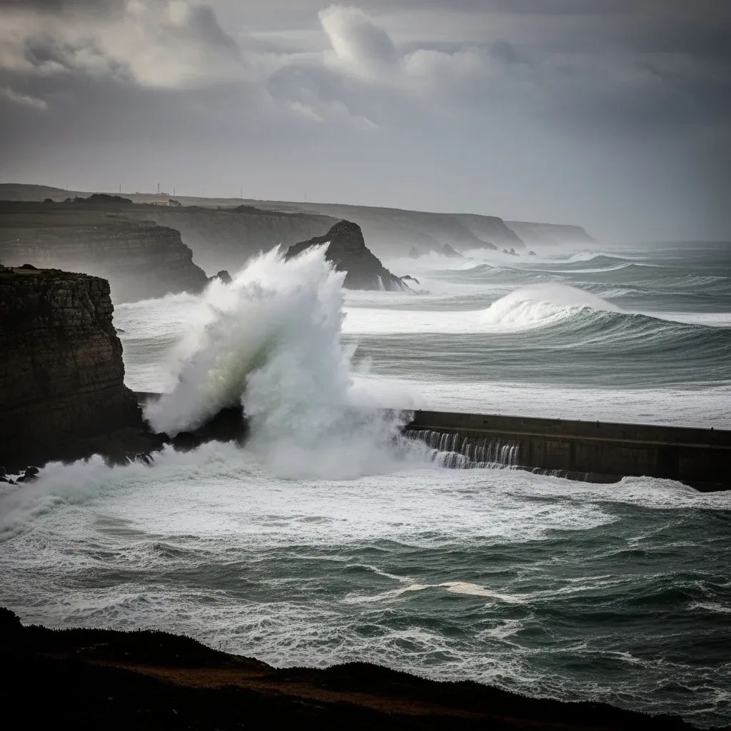
• Wave heights of 12 m on west-facing beaches, pressuring harbour operations.
• A fast-forming secondary low—Depressão Kristin—may follow, compounding damage.
Anatomy of the Storm
Joseph originated from a deep trough southwest of Ireland, dropped to 954 hPa overnight and is spiralling east-southeast. Unlike frontal systems that lose punch over cooler waters, this depression retains a powerful jet-stream feed, keeping its rain bands well organised. Forecast models suggest the core will skirt Galicia before slipping into Biscay, placing northern Portugal inside the corridor of severe southerly winds that funnel through river valleys and over the Douro escarpments.
Warnings by District
The Portuguese weather service, IPMA, has painted the map in three colours:
– Red alerts for wind in Porto, Aveiro, Coimbra, Braga, Viseu and Guarda during the small hours when peak gusts are most likely.– Orange alerts for heavy precipitation in Viana do Castelo, Vila Real, Leiria and Lisboa, where saturated soils raise the spectre of landslides.– Yellow advisories blanket the remaining districts for general instability, signalling travel disruption even where the storm’s core impact is lower.
Maritime authorities have hoisted double red flags from Caminha to Sagres, effectively banning leisure craft and warning commercial shipping to seek shelter.
Rain, Wind, Snow, Surf – The Four-Layer Threat
Rain: Hydrological models indicate 90–250 mm could fall in parts of the Norte during the coming 72 hours. With river levels already swollen from January’s earlier storms, low-lying towns such as Esposende and Águeda face renewed flood risk.
Wind: Forecast soundings point to a 70-knot jet streak descending to ridge level, making 120–150 km/h bursts plausible on the Serra do Marão crests and the coastal plateau between Porto and Aveiro.
Snow: A cold air pocket wrapping into the southern flank of Joseph will drag freezing levels to around 700 m, depositing 10–20 cm where A24 and A25 motorways cross higher ground.
Surf: Buoys west of Coruña already register 8 m significant wave height; peak sets could reach 12–14 m mid-week, overtopping sea walls in Figueira da Foz and Nazaré.
How Authorities Are Responding
The National Authority for Emergency and Civil Protection has escalated to its Level 4 readiness, mobilising additional firefighters, chainsaw units and power-grid technicians. Local councils are pre-positioning sandbags and temporary pumps near chronic flood spots, while highway operators prepare rolling closures on the A1 and A3 when crosswinds exceed safe limits. Rail operator CP warns of possible service curtailments north of Oporto should fallen trees block lines.
Storms in Context: Joseph Versus Recent Heavyweights
Compared with last winter’s Depressão Ingrid, Joseph’s sea state is milder but its wind field is broader, increasing the geographic reach of damage. It falls short of the Leslie 2018 benchmark—when hurricane-force gusts toppled power pylons across Leiria—but surpasses the more recent Chandra event in terms of snow potential. Meteorologists fear, however, that the explosive cyclogenesis of the trailing Kristin system could eclipse them all if its central pressure drops as forecast.
Staying Safe – Practical Steps for Residents
– Secure loose items on balconies and construction sites; temporary scaffolding is particularly vulnerable.– Clear rooftop gutters; blocked drains amplify water ingress during intense downpours.– Avoid forest roads and cliff-top walks while winds remain above 90 km/h.– Keep a flashlight, power bank and battery radio handy in case of outages.– If travelling between Porto and Lisbon, monitor Infraestruturas de Portugal updates; early morning rail or bus services may be cancelled at short notice.
The coming days will demand vigilance, but with timely preparation and attention to official bulletins, most households can ride out Depressão Joseph with minimal disruption while the nation awaits clearer skies.


