A pocket of polar air has thrown northern and central Portugal back into full-on winter mode this weekend, bringing the kind of snow-laden skies and icy roads that can paralyse high-altitude towns before Christmas even arrives.
Snapshot
• 6 districts upgraded to orange alert for heavy snow – Braga, Castelo Branco, Guarda, Viana do Castelo, Vila Real and Viseu.
• 4 districts on yellow alert – Porto, Bragança, Aveiro and Coimbra – where snowfall is likely but less intense.
• Snowline may slip to 600 m on Sunday morning, unusual for the coast-facing Minho and Douro regions.
• Authorities warn of road closures, fallen trees, disrupted power lines and possible delays on regional rail services.
• Further yellow alerts already issued for Monday in parts of the North and Centre.
Where and When the Snow Will Fall
The Instituto Português do Mar e da Atmosfera (IPMA) activated orange warnings in three waves: mid-afternoon on Saturday for Castelo Branco and Guarda, early evening for Vila Real, Viana do Castelo and Braga, and late evening for Viseu. All six expire at 09:00 on Sunday. The yellow tier for Porto and Bragança mirrors the 18:00-09:00 timetable, while Aveiro and Coimbra entered the window at 21:00 Saturday.
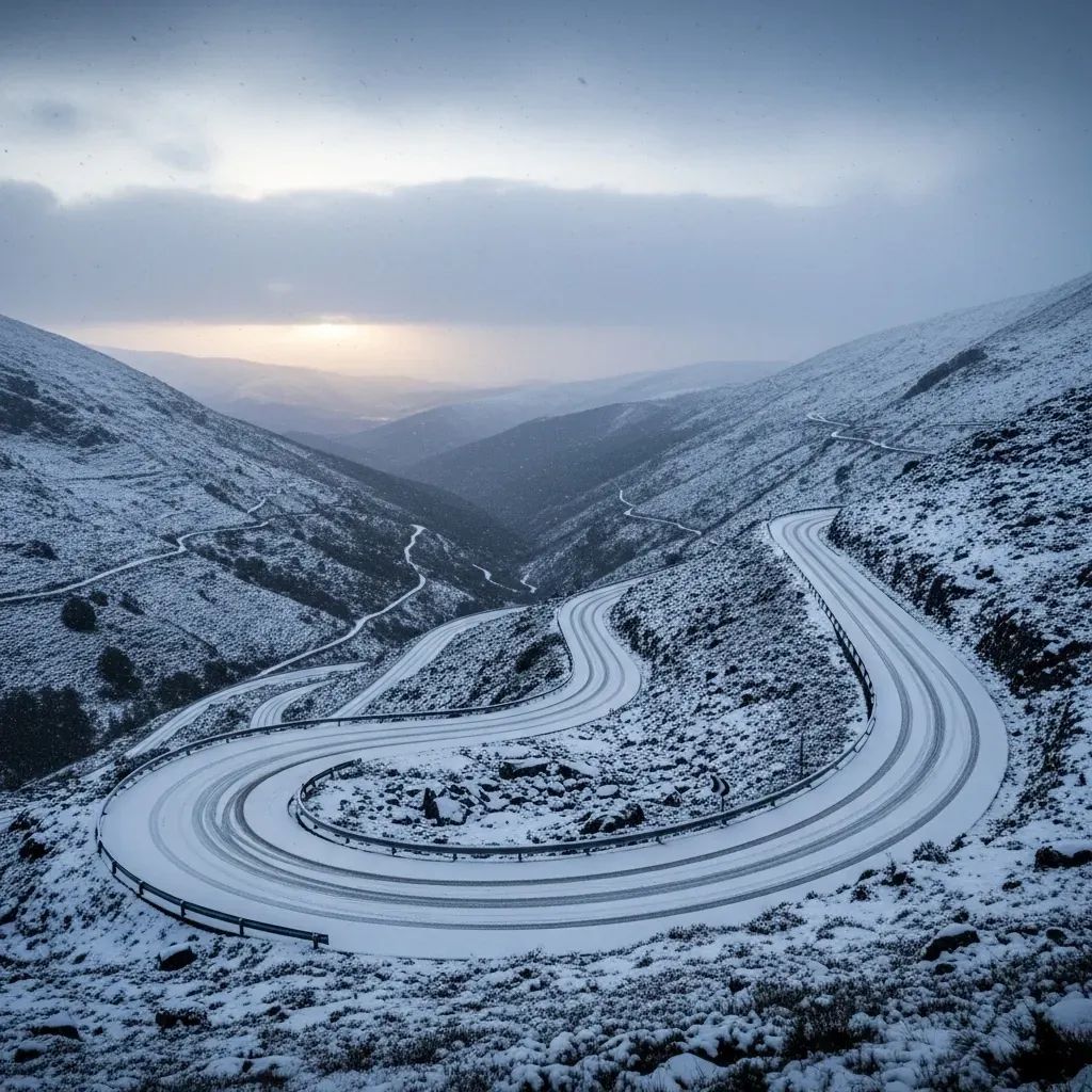
Forecast models indicate 5-15 cm on most northern and central ranges, jumping to 20-30 cm across the Serra da Estrela, Gerês, Larouco, Alvão/Marão and Montemuro. Above 1 000 m the blanket will be deep, but even plateaus around 800 m could see a powdery carpet of 1-5 cm. That matters for arterial routes such as the A24, A25 and IP2, where one lorry jack-knifed last winter and blocked traffic for six hours.
Why an Orange Alert Matters
Orange is IPMA’s second-highest tier, signalling “moderate to high risk”. It usually triggers municipal contingency plans, meaning snowploughs pre-positioned, shelters warmed up, and local civil protection units on 24-hour call. The difference from yellow? Heavier accumulations, faster icing and a higher chance that primary roads— not just mountain lanes— turn slick. For commuters living in satellite towns around Braga or Viseu, that could translate into stalled buses and improvised tele-work.
Getting Around Safely
Drivers heading over the Marão Tunnel, climbing the N2 in Vila Real, or descending into the Vale do Lima should pack:
Chains and a torch (mobile-phone flashlights drain too quickly in the cold).
A thermal blanket, water and a snack in case of stoppages.
A fully charged power bank – emergency hotlines may be saturated.
Urban dwellers are not off the hook. Black ice often forms on the shaded stretches of the VCI in Porto and the CRIL in Lisbon’s northern fringe when Arctic fronts sneak this far south. Keep to moderate speeds and avoid abrupt braking; Portuguese insurers report a 20 % spike in claims each time the mercury dips below zero overnight.
A Look Back: December Snowstorms and Their Costs
Portugal’s interior carries a long memory of December snowbursts. The 2020 cold snap shut dozens of schools across the Beira Interior; the March 2024 blizzard paralysed the Serra da Estrela ski lifts despite record visitor demand; and last year’s 21 December 2025 “nevão à moda antiga” blocked the A24 near Vila Pouca de Aguiar and left local councils with €3 M in clean-up bills. Economists at NOVA SBE estimate that every day of weather-related road closures shaves 0.02 % off regional GDP in the interior North.
What the Authorities Are Doing
Civil Protection commanders confirm that salt-spreading teams were deployed before dusk Saturday, while volunteer firefighters in Seia, Montalegre and Manteigas have snowchains fitted on ambulances. Infraestruturas de Portugal keeps a live map of road conditions; CP has alerted passengers on the Linha do Douro and Linha da Beira Alta of possible delays if fallen branches force speed restrictions. The Ministry of Health has re-broadcast its annual cold-weather advisory urging residents to layer clothing, ventilate heaters and check on elderly neighbours.
Looking Ahead: Monday and Beyond
The polar trough is expected to drift east by Monday afternoon, yet residual showers may keep Braga, Bragança, Vila Real, Viana do Castelo, Guarda and Castelo Branco under a yellow snow alert between 06:00 and 18:00. Temperatures will hover between 4 °C and 14 °C, climbing only marginally mid-week. IPMA’s long-range bulletin hints at a new Atlantic low on Christmas Eve – a reminder that winter has only just begun and Portugal’s mountainous backbone is likely to stay white well into January.
Bottom line: whether you plan to chase the first snowflakes up the Serra da Estrela or simply commute over Porto’s Arrábida Bridge on Monday morning, keep a close eye on the IPMA updates, respect road closures and prepare for slower-than-usual journeys. The white scenery is beautiful, but Portugal’s relief map turns it into a logistical test every time the snowline slides below 1 000 m.