Driving home along the coast has turned into a game of patience this week, as authorities juggle road closures, swollen rivers and towering Atlantic waves. Municipal officials assure residents that the restrictions are temporary, yet the orange-level alerts issued by the national weather service signal that the relief may be gradual rather than immediate. For anyone navigating early-morning commutes or planning a long weekend escape, the advice is simple: check the latest updates before leaving the house, keep an eye on the sky, and never underestimate the power of a November storm.
Storm grips mainland
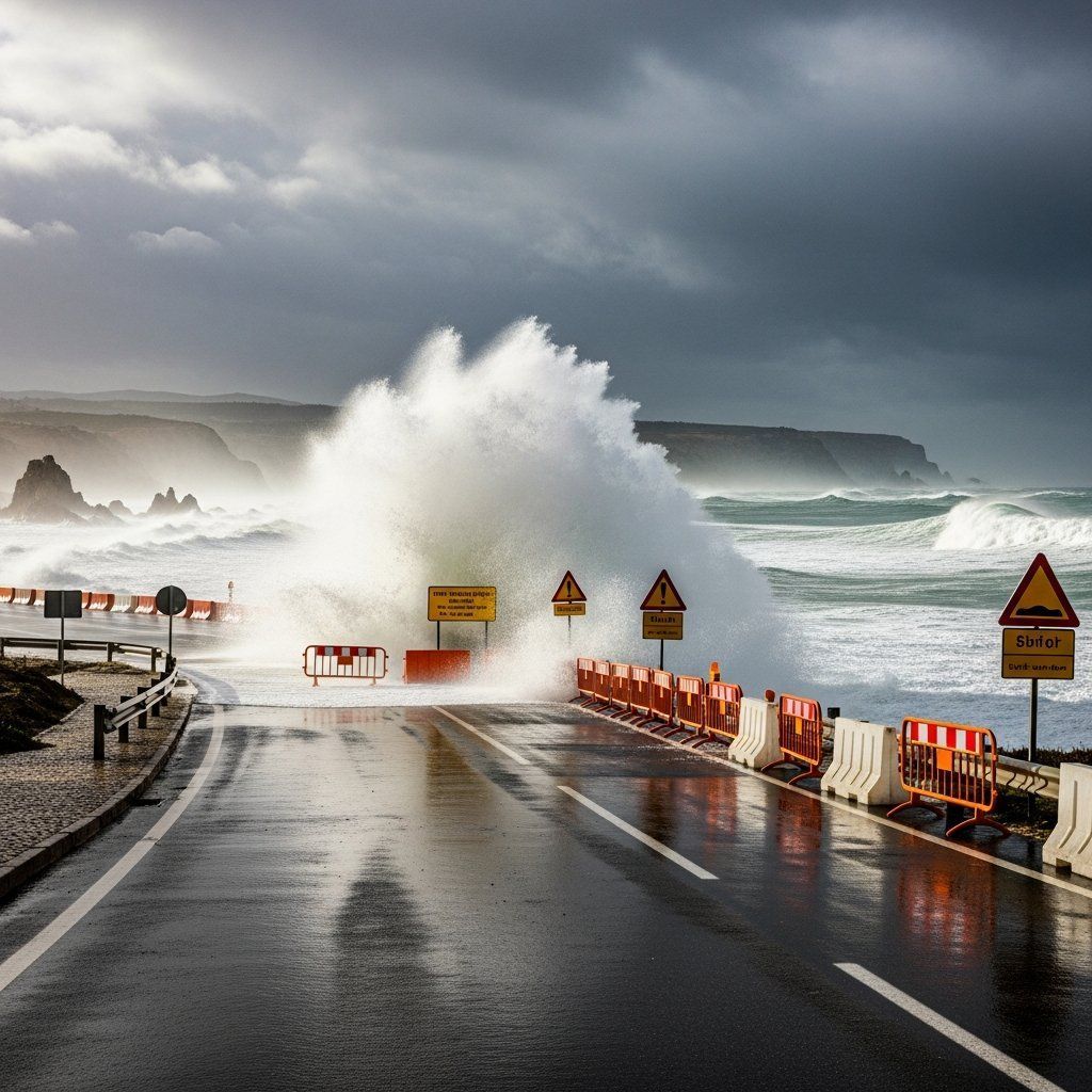
Meteorologists at IPMA have placed almost the entire mainland under orange warnings for what they describe as a “dynamic conveyor belt” of low-pressure systems. The atmosphere over Viana do Castelo, Porto, Aveiro, Coimbra, Leiria, Lisboa and Faro is primed for bursts of torrential rain, while inland highlands brace for wind gusts that could top 100 km/h. In coastal districts, the focus is on the sea state, where models point to significant wave heights of 5 to 6 m and occasional crests flirting with 9 m. Even Bragança, the only district spared the orange designation, remains under a lesser yellow alert, underscoring how widespread the disturbance truly is. Climatologists stress that the frequency of such high-impact events has climbed sharply over the past decade, a trend intimately linked to warmer ocean surfaces and shifting jet-stream patterns.
Trouble spots on the map
The most visible disruption is unfolding along Porto’s riverfront. City Hall erected barriers on Avenida D. Carlos I after seawater began splashing over the granite walls, cutting both pedestrian and vehicle access. A similar story is playing out on parts of the Via de Cintura Interna, where runoff backed up inside tunnels before dawn, triggering a temporary shutdown of the Boavista exit. In mountainous terrain the picture changes: the EN-339 in Serra da Estrela re-opened at first light after snowploughs and forestry crews removed downed pines and ice. Yet foresters admit that if wind-driven squalls return overnight, the high-altitude stretch between Piornos and Lagoa Comprida could close once more. Farther south, scattered blockages on the A2 near Grândola and low-lying roads skirting the Sado estuary remind drivers that heavy rainfall is just as capable of paralysing flat land as it is of isolating hill towns.
What the forecasts say next
Synoptic charts show the current depression sliding eastward, but a reinforcing trough is expected to arrive from the northwest before skies can clear. Forecasters predict another burst of convective showers, most intense in the Minho and Douro valleys during the small hours, then shifting to the Lisbon Peninsula by mid-afternoon. The wave field lags the rain by several hours; as the wind veers to northwest, breakers will remain elevated through at least Friday morning. That means harbour masters in Leixões, Figueira da Foz and Cascais are keeping fishing fleets in port and suspending recreational boating. Maritime pilots warn that even seasoned surfers should steer clear of exposed reefs, as long-period swells can knock swimmers off their feet well beyond the shoreline. The outlook improves slowly over the weekend, with swell heights expected to retreat to 2.5 m by Sunday, though residual showers may linger in the Alentejo interior.
How civil protection is responding
Inside the national command centre in Carnaxide, dozens of screens track rainfall radar, flood gauges and wind vectors in real time. The National Emergency and Civil Protection Authority has elevated its readiness posture, deploying extra teams of sapadores to prune unstable branches and pre-positioning pumps near known flash-flood hotspots in Coimbra and Setúbal. In Porto, firefighters completed a pre-emptive tour of subterranean car parks along the Ribeira, ensuring that floodgates and back-flow valves are operational. Meanwhile, coastal councils from Matosinhos to Nazaré have explicitly advised locals to secure awnings, antennas and loose garden furniture, a move intended to prevent debris from turning into airborne projectiles. Insurance brokers note that claims for storm damage jumped nearly 40 % between 2015 and 2024, a statistic they blame on more frequent incursions of subtropical moisture.
Looking further ahead
Infrastructure planners see the latest round of disruptions as another data point in a broader climate ledger. In January the government earmarked €20.2 M for shoreline reinforcement, from the crumbling wall at Praia de Lavadores to the eroded groynes off Ofir. A separate tranche under the Sustainable 2030 Programme is funnelling funds into dune-rehabilitation projects and artificial sand nourishment—a strategy designed to absorb wave energy long before it reaches seaside promenades. Environmental engineers argue that such interventions must accelerate if Portugal hopes to stay ahead of heavier winter rainfall and accelerating sea-level rise. For now, the focus remains on the immediate storm: clearing drains, rerouting traffic and waiting for the surf to calm. Yet each closure, each flooded underpass, is a reminder that adaptation is no longer a distant priority; it is the rhythm of daily life along this weather-beaten Atlantic edge.


