The Portugal Institute for Sea and Atmosphere (IPMA) has kept much of the mainland under an orange maritime warning and reinforced snow alerts inland, a decision that will reshape travel, schooling and even grocery deliveries for the rest of the week.
Why This Matters
• Snow down to 600 m altitude could close mountain roads as early as tonight.
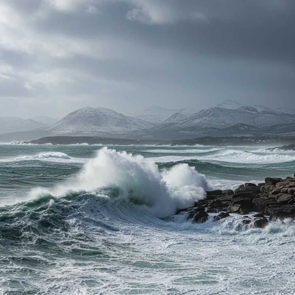
• Waves up to 12 m are forecast on the west coast, forcing small-boat fleets back to harbour and likely disrupting fresh-fish supplies.
• Mobile alerts from the Portugal Civil Protection Authority (ANEPC) will be tested nationwide; keep phones charged to receive them.
• Insurance claims for storm damage must be filed within 8 days—document evidence now.
How We Got Here
What began as the tail end of Depression Ingrid in late January has merged with a conveyor belt of Atlantic lows—first Joseph, now Leonardo—that is tapping unusually warm ocean water off the Azores. Ingrid’s passage battered northern coastlines with 15 m rogue waves and left 10,000 households briefly without power. Although Ingrid itself has moved on, the disturbed pressure field it created is funnelling fresh moisture and wind directly over mainland Portugal.
The 72-Hour Forecast at a Glance
• Wednesday evening: Rain returns to Minho and Trás-os-Montes, turning to wet snow above 800 m after dusk.• Thursday: Gusts flirting with 110 km/h on exposed capes from Viana do Castelo to Peniche; morning commute in Porto expected to see standing water on the VCI.• Friday: The cold core of Leonardo descends, dropping the snow line to 600 m—Bragança, Guarda and Serra da Estrela ski operators expect the best dump since 2021.• Saturday–Sunday: Swell peaks; IPMA’s offshore buoy off Nazaré already models a 14 m maximum wave late Saturday night.
Measures Already in Force
The Portugal Civil Protection Authority has activated readiness level 3 (on a scale of 4). Municipal crews from Caminha to Sines have started sealing beachfront carparks and erecting flood barriers in historically vulnerable ribeiras. Meanwhile, E-Redes has pre-positioned generator trucks near fragile mountain villages where ice tends to snap powerlines. In coastal towns, seafood auctions are preparing to trade by telephone instead of on-site if ports are sealed.
What This Means for Residents
Commuting: Expect chain-control orders on the A24 and A25; bring snow socks or risk fines. CP rail has announced potential speed restrictions north of Coimbra—allow an extra 40 minutes.
Utilities: Use today’s calmer hours to charge power banks. Long-duration cuts are unlikely, but brief outages are common when wet snow accumulates on cables.
Home & Business Insurance: Under Portuguese law you have 8 calendar days to notify insurers of storm damage. Photos with a time-stamp are accepted proof—take them before clearing debris.
Remote Work & School: Several mountain municipalities—including Seia and Manteigas—have already green-lit optional remote schooling for Friday. Employers in the tech corridor of Oeiras are expected to follow suit; labour law allows telework in situations of civil protection alerts without contract addenda.
Ports, Fishers & Supply Chains
The Portugal Maritime Authority has ordered small-scale fleets in Setúbal, Peniche and Figueira da Foz to remain docked once the orange warning escalates to red—currently projected for early Friday. Supermarkets in the interior that depend on daily coastal fish auctions may see reduced fresh-fish counters; alternative supply from Spain’s Galicia region is being negotiated. Container terminals at Leixões and Sines, by contrast, are designed for these conditions and plan normal operations, though truck pickup slots could slip.
Tourism & Outdoor Plans
For those who booked long-weekend escapes to Serra da Estrela, the snow is excellent news—if you can get there. Chains are obligatory on the N339 after Lagoa Comprida, and the GNR typically enforces closures once wind gusts exceed 90 km/h. Coastal tourism boards from Cascais to Lagos are discouraging cliff walks; fines for ignoring sealed footpaths run to €250, roughly the cost of a month’s commuter train pass.
Looking Ahead: Could Leonardo Outdo Ingrid?
Meteorologists at IPMA stress that Leonardo’s precipitation totals may exceed Ingrid’s but wind speeds should be slightly lower. The greatest uncertainty is whether a secondary low forms over the Gulf of Cádiz on Sunday—if it does, the Algarve could see rare February thunderstorms. Computer models diverge after Monday, yet all agree Portugal remains in a storm-track until at least mid-February.
Bottom Line for Investors & Expats
• Property owners: Delay roof work; contractors’ insurance typically voids coverage once an orange warning is issued.• Agribusiness: Vineyards in the Douro should monitor soil saturation—February pruning may need to pause to avoid tractor slippage.• Expats in coastal condos: Verify basement pumps are functional; damage caused by saltwater incursions is often excluded from standard policies.
The sequence of storms is testing infrastructure but also showcasing Portugal’s upgraded early-warning systems. Stay plugged into IPMA bulletins and ANEPC SMS alerts—they are now the difference between inconvenience and real loss.